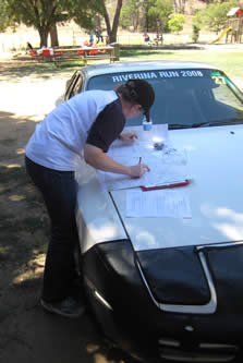
Most rallies are run at three levels: Master, Apprentice and Tour. There may be slight differences in the routes driven by the classes, but the key difference is the level of difficulty in the navigation.
Tour
The Route Instructions provided for the Tour Class are quite specific.
You will be given the exact distance at which you need to make turnings, etc, and may even be given road names or signpost details.
The Instructions will use standard rally abbreviations (e.g. BL=bear left, TR=turn right, RL=railway line, XR=cross roads, etc) so it is a good idea to familiarise yourself with these. The Supplementary Regulations for the rally will normally contain a list of abbreviations used.
- Sample Route Instructions for the Tour class (from 2007 Alpine Classic)
In some rallies, you may be able to do the entire Tour Class without ever looking at the supplied maps: everything you need is on the Route Instructions. In other cases, a very small amount of map reading may be required.
Apprentice and Master

The Apprentice and Master Classes offer much more significant navigational challenges than the Tour Class.
Instead of being given step-by-step instructions, you will actually need to work out your route on the map.
For example, you may have to travel between two points on the map, crossing over a railway line exactly three times. Or get to a cross road that is directly south of an airfield, after using three mapped km of a secondary road.
The Route Instructions for the Apprentice and Master Classes are basically the same, but the Apprentices will receive some extra information. For example, the Master instructions might say "Drive west past a quarry", where the Apprentice says "Drive west past a quarry near Pelton".
- Sample Route Instructions for the Apprentice class (from 2007 Alpine Classic)
- Sample Route Instructions for the Master class (from 2007 Alpine Classic)
These instructions may seem terrifying - even impossible - but with practice you will find they are quite achievable. The How to navigate page of this website has a lot of useful information for first-time Apprentice and Master navigators, including a list of tools, documentation from rally schools, and a full set of director instructions. In addition, at the start of the year, the Classic Rally Club sometimes runs Navigation Schools.
Before attempting a rally at this level, you need to be familiar with:
- Grid references on a map
- How geographic and other features are shown on a map: mines, railways, powerlines, dams, route markers, road types, etc. (All of these will be shown on the Map Legend.)
- Compass directions
- Rally terminology
- Rally puzzles, such as "herringbones" and "tulips"

